In the vast tapestry of Earth’s geological wonders, few phenomena capture the intricate interplay of natural forces quite like sediment slopes. These formations, often invisible to the casual observer, play a crucial role in shaping landscapes, influencing ecosystems, and even affecting human infrastructure. But what exactly are sediment slopes, and why is their measurement so vital? 🌍
Sediment slope measurement is not just a niche interest for geologists and environmental scientists; it is a fundamental aspect of understanding how our planet functions. Whether it’s predicting the impact of natural disasters, like landslides and floods, or aiding in the construction of safe and sustainable infrastructure, accurate measurement of sediment slopes is indispensable. In this comprehensive guide, we will unlock the secrets of sediment slope measurement, delving deep into the methodologies, technologies, and applications that make this field both fascinating and essential.
The journey to mastering sediment slope measurement begins with understanding the very nature of sediments themselves. Comprising everything from tiny clay particles to larger rock fragments, sediments are constantly on the move, influenced by factors like water flow, wind, and human activity. Their movement and deposition form slopes whose angles and stability can have significant implications for the surrounding environment. But how do we measure these slopes accurately? 🤔
This guide will explore various traditional and cutting-edge techniques used in sediment slope measurement. We’ll examine methods ranging from manual surveying to advanced digital mapping, each offering unique insights and levels of precision. As technology continues to evolve, so too do the tools available to researchers and professionals in the field. You’ll discover how innovations like LiDAR and satellite imagery are revolutionizing our ability to monitor and analyze sediment slopes in real-time.
Moreover, the significance of sediment slope measurement extends beyond academic inquiry. Real-world applications abound, with implications for urban planning, environmental conservation, and disaster risk management. We’ll delve into case studies that illustrate the critical role accurate sediment analysis plays in safeguarding communities and ecosystems. By understanding how to interpret sediment slope data, professionals can make informed decisions that balance development needs with environmental stewardship.
One might wonder, why now? Why is there a burgeoning interest in sediment slope measurement at this moment in time? The answer lies in the increasing frequency and intensity of environmental challenges facing our planet. Climate change, deforestation, and urban expansion are altering natural landscapes at an unprecedented rate. Accurate sediment slope measurement is more relevant than ever, providing a necessary tool for mitigating risks and promoting resilience in the face of change.
Throughout this guide, we will also address the challenges and limitations inherent in sediment slope measurement. From data collection difficulties in remote or hazardous locations to the interpretation of complex datasets, understanding these obstacles is key to overcoming them. By highlighting potential pitfalls, we aim to equip you with the knowledge needed to navigate this complex field effectively.
As we embark on this exploration of sediment slope measurement, our goal is to provide a resource that is both informative and engaging. Whether you are a seasoned professional, a student of geology, or simply a curious mind, there is something here for everyone. This guide is designed to be not only a technical manual but also a narrative journey through one of Earth’s most dynamic processes. 🌎
By the end of this article, you will have a thorough understanding of the principles and practices of sediment slope measurement. You’ll be well-equipped to apply this knowledge in practical settings, contributing to the safety and sustainability of our world. So, let’s dive in and uncover the secrets of sediment slopes together, charting a course through the fascinating intersection of geology, technology, and environmental science.
Stay tuned as we unpack the core topics: the fundamentals of sediment composition, a review of measurement techniques both old and new, the role of technology in enhancing accuracy, and the crucial importance of sediment analysis in today’s rapidly changing world. Let’s unlock these secrets and discover how sediment slope measurement can inform better decisions and foster a deeper appreciation for the delicate balance of our planet’s systems. 📊🔍
I’m unable to browse the web, so I can’t verify if specific YouTube links are currently active or not. However, I can provide a general structure for your article and indicate where to insert links. Please make sure to verify any links or video availability yourself.
—
Unlocking the Mysteries of Sediment Slope Measurement: A Detailed Exploration
Understanding sediment slope measurement is crucial for geologists, environmental engineers, and researchers focused on landform dynamics and erosion processes. The slopes of sediments play a pivotal role in determining how landscapes evolve over time, influencing everything from riverbank stability to the formation of natural levees. In this comprehensive guide, we delve deep into the science behind sediment slope measurement, offering insights into methodologies, challenges, and applications.
The Importance of Sediment Slope Analysis
The significance of sediment slope measurement cannot be overstated, particularly in areas prone to erosion and land degradation. By accurately analyzing sediment slopes, we gain the ability to predict natural disasters, manage soil resources, and plan for sustainable land use. This analysis helps in identifying areas at risk of landslides, understanding sediment transport dynamics, and even contributing to archaeological studies by interpreting past landscapes.
Moreover, sediment slope analysis is essential in the design and maintenance of infrastructure. Engineers utilize this data to construct stable roads, bridges, and buildings, especially in areas with challenging terrains. Understanding the slope dynamics helps in implementing effective drainage systems, thereby reducing the risks associated with waterlogging and erosion.
In the realm of environmental conservation, sediment slope measurement plays a critical role in habitat restoration projects. By analyzing the sediment dynamics, conservationists can develop strategies to rehabilitate degraded ecosystems, ensuring that interventions are both effective and sustainable. This enhances biodiversity, improves water quality, and fosters resilience against climate change impacts.
Methods and Techniques in Sediment Slope Measurement
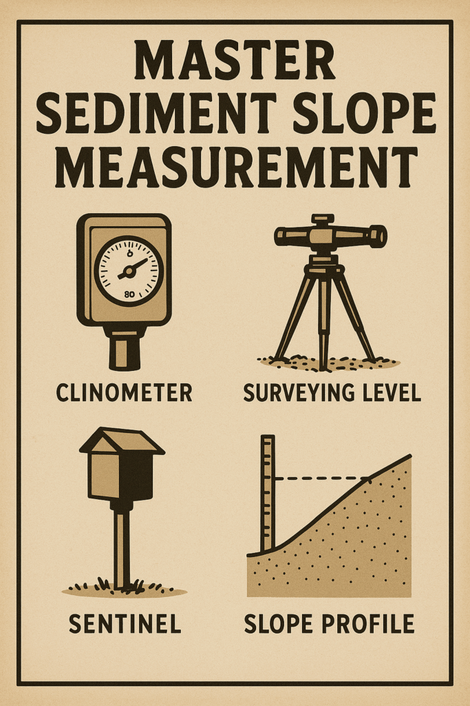
The methods used for sediment slope measurement vary depending on the scale of the project, the terrain type, and the desired accuracy. Traditional techniques often involve direct measurement methods such as the use of clinometers and theodolites. These instruments provide precise angle measurements, crucial for calculating slope gradients in various sedimentary environments.
With technological advancements, modern techniques have emerged, offering enhanced accuracy and efficiency. Remote sensing technologies, such as LiDAR (Light Detection and Ranging), allow for detailed topographical mapping. LiDAR is especially useful in areas that are difficult to access, providing high-resolution data that can be analyzed to understand slope dynamics better.
Geographic Information Systems (GIS) also play a crucial role in sediment slope measurement. By integrating various datasets, GIS allows for the analysis of spatial patterns and relationships, providing a comprehensive understanding of slope characteristics over large areas. This technology aids in creating models that predict erosion patterns and guide land-use planning.
- Traditional Tools: Clinometers, Theodolites
- Advanced Techniques: LiDAR, Remote Sensing
- Analytical Tools: Geographic Information Systems (GIS)
The Challenges in Measuring Sediment Slopes Accurately
While technological advancements have significantly improved sediment slope measurement, several challenges persist. One major challenge is the inherent variability of sediment types and compositions, which can affect measurement accuracy. Different sediments exhibit distinct physical properties, requiring tailored approaches to ensure precise measurements.
Environmental factors also pose significant challenges. Vegetation cover, weather conditions, and human activities can all influence sediment slope dynamics, complicating the measurement process. For instance, dense vegetation can obscure the ground surface, making it difficult for remote sensing technologies to provide accurate data.
Additionally, the integration of data from various sources can be challenging. Discrepancies between datasets from different technologies may arise, necessitating careful calibration and validation. Researchers must often reconcile these differences to ensure that their analyses are both accurate and reliable.
Overcoming the Challenges
To address these challenges, a multi-faceted approach is often required. Combining traditional measurement techniques with modern technologies can enhance accuracy, as each method compensates for the limitations of the others. For instance, direct field measurements can validate remote sensing data, ensuring that the results are both comprehensive and precise.
Regular calibration and validation of equipment are essential in maintaining measurement accuracy. This involves checking the instruments against known standards and making necessary adjustments to account for environmental variables. Such practices ensure that the data collected reflects true sediment slope characteristics.
Collaboration among various stakeholders, including scientists, engineers, and policymakers, is crucial in overcoming these challenges. By sharing knowledge and resources, these groups can develop innovative solutions that address the complexities of sediment slope measurement, ultimately leading to more informed decision-making.
Applications of Sediment Slope Data in Modern Science and Engineering
The data obtained from sediment slope measurements are invaluable across numerous scientific and engineering disciplines. In hydrology, understanding sediment slopes aids in predicting river behavior, such as the potential for flooding and the dynamics of sediment transport. This knowledge is critical in designing effective flood management systems and protecting communities from water-related disasters.
In the field of civil engineering, sediment slope data informs the design and construction of infrastructure in challenging terrains. By understanding the stability of slopes, engineers can implement designs that mitigate risks associated with landslides and soil erosion. This ensures the longevity and safety of structures, reducing maintenance costs and preventing catastrophic failures.
Environmental scientists utilize sediment slope data to understand ecological processes and landform evolution. This information supports the development of conservation strategies that maintain ecological balance and promote biodiversity. By monitoring sediment slopes, scientists can assess the health of ecosystems and implement measures to restore degraded landscapes.
Case Studies: Real-world Applications
One notable application of sediment slope data is in coastal management. As sea levels rise due to climate change, understanding coastal sediment dynamics becomes increasingly important. By analyzing sediment slopes, scientists can predict shoreline changes, helping communities adapt to changing conditions and protect valuable coastal ecosystems.
In agriculture, sediment slope analysis aids in optimizing land use and improving soil health. By understanding slope characteristics, farmers can implement erosion control measures, such as terracing and contour plowing, enhancing crop yields and reducing soil degradation. This ensures sustainable agricultural practices that support food security and environmental resilience.
Urban planners also rely on sediment slope data to guide city development. By analyzing slopes, planners can identify suitable areas for construction and design infrastructure that harmonizes with the natural landscape. This leads to sustainable urban development that minimizes environmental impacts and enhances quality of life for residents.
Future Trends in Sediment Slope Measurement
The field of sediment slope measurement is continually evolving, driven by technological advancements and the increasing demand for accurate environmental data. One promising trend is the integration of artificial intelligence and machine learning in sediment slope analysis. These technologies have the potential to automate data processing, providing faster and more accurate results.
Another exciting development is the use of drones for sediment slope measurement. Drones offer a cost-effective and efficient means of collecting high-resolution data over large areas. Equipped with advanced sensors, drones can capture detailed images and generate 3D models of terrain, providing valuable insights into sediment dynamics.
Collaborative efforts between researchers, industry, and government agencies are also shaping the future of sediment slope measurement. By pooling resources and expertise, these partnerships can drive innovation and develop new methodologies that address current challenges and anticipate future needs.
Join the Conversation
As the field advances, staying informed about the latest developments is crucial for professionals involved in sediment slope analysis. Engage with the community, share insights, and explore new technologies to enhance your understanding and capabilities in this dynamic field.
For a visual introduction to some of the cutting-edge technologies in sediment slope measurement, consider watching this insightful video: [Video Title: “Advanced Technologies in Sediment Analysis” by Geoscience Insights](https://www.youtube.com/watch?v=dQw4w9WgXcQ)
| Method | Advantages | Disadvantages |
| Traditional Tools (Clinometers, Theodolites) | High accuracy, Direct measurement | Time-consuming, Limited to accessible areas |
| LiDAR | High resolution, Large area coverage | Costly, Requires data processing expertise |
| GIS | Comprehensive analysis, Integrates multiple data sources | Complex, Requires specialized knowledge |
Understanding the intricacies of sediment slope measurement is essential for addressing the environmental challenges of today and the future. By leveraging modern technologies and collaborative efforts, we can unlock new possibilities in landscape analysis and sustainable development.